Children can learn about the continents with this free World Map Activities printable set that makes learning fun and interactive.
Thank you for visiting. This post may contain affiliate links to recommended products at no extra cost to you. Read our Disclosures and Terms of Use. Don't miss out again, become a Reader here <--it's FREE.
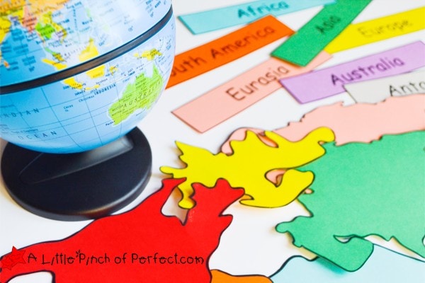
After our Solar System Activities I figured we needed to talk about things a little closer to home, or at least on our planet. So today I am sharing World Map Activities and free printables that can be used as coloring pages for the continents as well as labels for matching and reading. It’s a great time to learn about geography!
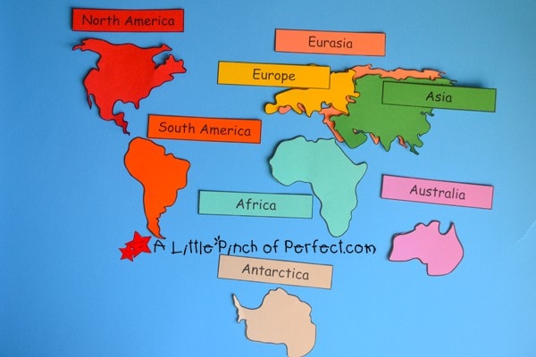
When I was in school I remember being taught that there are 7 continents (North America, South America, Asia, Europe, Australia, Africa, Antarctica) and I always thought it was weird that Asia and Europe were considered continents even though they are clearly attached together. Some now believe that there are only 6 continents combining Europe and Asia, and still others believe there are only 5 continents combining North and South America.
Not sure which idea is more popular now, I made a 7 continent printable and a 6 continent printable to make sure my daughter would learn both ways in our world map activity. You can read more about continents here National Geographic FAQ.
This post is part of the Creative Preschool Series, please make sure to see what other fun Map themed activities our team has come up with at the bottom of this post. and in case you missed it here are more topics we have covered; Shapes, Science Experiments, Learn About Food, Fine Motor Skills, Hair & Body, Fairy Tales, Ocean, Plants & Flowers.

Build a World Map
Supplies:
- World Map Continent Printable (available towards the bottom of this post)
- Large blue poster board (optional)
- Globe (optional)
Directions:
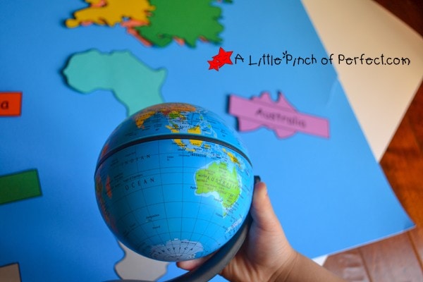
Use the continents to build a world map. We did this activity two ways. First I laid down the continents in their relative location, and then my daughter placed the matching name on top of the continent. Since I printed each continent on a different colored piece of paper, she was able to easily match the colors together. The second way we did this was I laid down the names, and she placed the continents. We used our globe as a reference to figure out how our continent should be oriented (top, bottom).
We compared our paper continents with the one on our globe. Then, we located our home and talked about people we know on other continents. This world map activity helped her engage with both the names and placement of the continents.
World Map: Pangea!
Supplies:
World Map Continent Printable (available towards the bottom of this post)
Large blue poster board (optional)
Directions:
Cut out continents and move them around to form one big land mass. We did this several times. It was fun trying to fit the pieces together like a puzzle. We talked about how long ago the continents used to be all together but they broke apart to create our modern day world. You can also check out this short video for kids to learn more about Pangea.
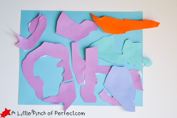
Create Your Own World Map
Supplies:
- Multi colored craft paper including blue
- Scissors
- Glue
- Markers
Directions:
As part of an imaginative play activity we decided to make our own world and continents. Once you’ve explored our world, have your child draw their own continents on multi colored paper, cut them out, and then glue them on their blue piece of paper. My daughter had a whole story about her world and the people who lived on it. It was fun watching her create and talk about her own continents.
If you are doing this with a class or large group it would be fun to build a map together by having each child add their own continent.
Preschool Map Activities by Creative Preschoolers
Alphabet Ocean Hunt (Free ABC Ship Printable)
COMPLETE YOUR ACTIVITY:
Click photos: Affiliate links to more information on these activities we love!
(Purchases through affiliate links earn us a small commission with no extra cost to you. See our Disclosure Policy here.)
World Map Activities Continent Printable
DOWNLOAD THE TEMPLATE HERE:
Don’t see the box? CLICK HERE to be directed to the download.Please share and pin our printable ? While you are here, take a look at more of our Free Printables.
Thank you!
This was a perfect project to wrap up our 3 week study on the world and it’s continents! Thank you so much, my 3 girls loved it!
Hi, just to say that i loved that. Thanks for sharing <3
I was taught that there are 6 CONTINENTS and 7 PARTS OF THE WORLD. Eurasia is a continent, Europe & Asia are parts of the world. So no confusion 🙂 Thank you for sharing!
I didn’t know people taught 6 continents either. I always heard 7 continents; that’s what I was taught, and that’s how we were taught to teach it to children when in college. North America, South America, Africa, Europe, Asia, Australia, and Antartica. Never heard of Eurasia. Ever. Never heard of 6 continents until now.
fun introduction to geography! Thanks for sharing at our FB Share Day!
These look like fun activities. Oof. I didn't know that there was debate about the number of continents! I feel like I need to go back to school again to learn all these facts (and Pluto not being a planet… whaaat?)
I love your daughter created a story to go with her world map. What a great way to explore other cultures and the whole world!